 geocat.ch
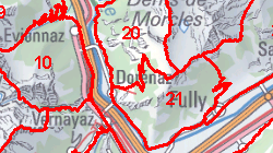
Secteurs pour la chasse de sangliers
Zones dans lesquelles la chasse spéciale du permis S (permis sanglier) est autorisée selon Art. 24 et 25 de l'Arrêté quinquennal sur la chasse.
Simple
- Alternate title
-
Chasse de sangliers
- Date (Creation)
- 2013-10-10
- Date (Revision)
- 2022-06-21
- Identifier
- 391
- Purpose
-
Elaboration d'une carte remise avec le permis de chasse
- Status
- Completed
Custodian
- Spatial representation type
- Vector
Spatial resolution
Equivalent scale
- Denominator
- 25000
- Topic category
-
- L Environment
Extent
Extent
- Description
-
Canton of Valais (VS)
))

- Maintenance and update frequency
- Irregular
Resource format
- Title
-
ESRI Enterprise Geodatabase
- Date
- GEMET themes
-
-
natural dynamics
-
- GEMET
-
-
resources
-
- GEMET
-
-
hunting
-
- geocat.ch
-
-
opendata.swiss
-
Resource constraints
- Use limitation
-
aucunes
Resource constraints
- Access constraints
- Other restrictions
- Other constraints
-
Géodonnées accessibles au public (niveau A selon l'OGéo)
- Other constraints
-
Les conditions générales d'utilisation des géodonnées du Canton du Valais font foi ( https://www.vs.ch/fr/web/guest/information-legale).
- Language
- Français
- Character encoding
- UTF8
- Environment description
-
-
- Subtopic Category
- L2 Nature and Landscape Protection
- Distribution format
-
-
ESRI Shapefile (SHP)
-
OGC Web Map Service (WMS)
-
ArcGIS REST Feature Service
-
Distributor
Digital transfer options
- OnLine resource
-
Géoportail du Canton du Valais
Géoportail du Canton du Valais
Digital transfer options
- OnLine resource
-
OpenData Valais
OpenData Valais - Site de téléchargement de géodonnées à l'Etat du Valais : multiformat et WebMercator
Digital transfer options
- OnLine resource
-
Landing Page
Landing Page pour opendata
Digital transfer options
- OnLine resource
-
Permalink opendata.swiss
Permalink opendata.swiss
Digital transfer options
- OnLine resource
-
5
Secteurs pour la chasse de sangliers
Digital transfer options
- OnLine resource
-
Zones_sanglier_chasse
Secteurs pour la chasse de sangliers
- Statement
-
Digitalisation sur la base de la carte nationale
- Hierarchy level
- Dataset
- Description
-
Digitalisation
- Geometric object type
- Surface
- Geometric object count
- 27
- Reference system identifier
- EPSG:2056/CH1903+_MN95
Metadata
- Metadata identifier
- e09d39c0-6a3c-4197-8da0-18007f5a2332
- Language
- Français
- Character encoding
- UTF8
- Language
- Deutsch
- Character encoding
- UTF8
- Language
- Italiano
- Character encoding
- UTF8
- Language
- English
- Character encoding
- UTF8
- Language
- Rumantsch
- Character encoding
- UTF8
Distributor
Type of resource
- Resource scope
- Dataset
- Metadata linkage
-
https://geocat-int.dev.bgdi.ch/geonetwork/srv/api/records/e09d39c0-6a3c-4197-8da0-18007f5a2332
- Date info (Creation)
- 2018-03-06T16:16:15Z
- Date info (Revision)
- 2026-04-13T09:37:50.016783Z
Metadata standard
- Title
-
GM03 2+